

Our route “Rounding the Horn” & rotating the ship 360 degrees so all sides could view.
January 11, 2015 – We approach the southern-most land mass on earth excluding Antarctica… the Horn of South America. This is mid-summer down there, equivalent to our July. Outside of the near freezing temperatures, high winds, and at times turbulent seas, it seams like a wonderful place to retire. Look at the pictures and see if you agree.
One surprise I had… Cape Horn is not on the mainland of South America. It’s an island, one of hundreds of islands that lie below the mainland. With the myriad of passages between islands, dead-end fjords, unfavorable winds and rocks above and below the surface, it’s no wonder this area was such a challenge for the early explorers in sailing ships. A number of them got so lost, they committed suicide.
The occassional picture off our TV on our “navigation channel” shows the GPS location of our ship where following pictures were taken.
Click first image to start slideshow… As you page through pictures, note captions that describe the trip.
-

- Our route that day, took us from the Argintine waters in the Atlantic Ocean, into the Pacific and Chilean waters as we rounded the horn, then back to Argentina again, heading for our next port of call, Ushuaia, Argentina, southern most city on earth.

-

- Our route “Rounding the Horn.” Red dot is location of Chilean Naval Station. Ship circles at that point so all can see before heading back toward Atlantic and Argentina.

-

- Land first comes into view off the starboard side. Our cabin was on that side so we got to see more land than others as we cruised off Argentina, rounded the horn into Chile and headed back north along Chile.


-

- Winds and seas are picking up.


-

- In Chilean waters now.


-

- Watching for pictures from the warmth of our cabin.

-

- “Cape Horn” first coming into view

-

- High peak ahead is part of Hornos Island (Cape Horn)


-

- We’re there. Following pictures taken as we “Round the Horn.”

-

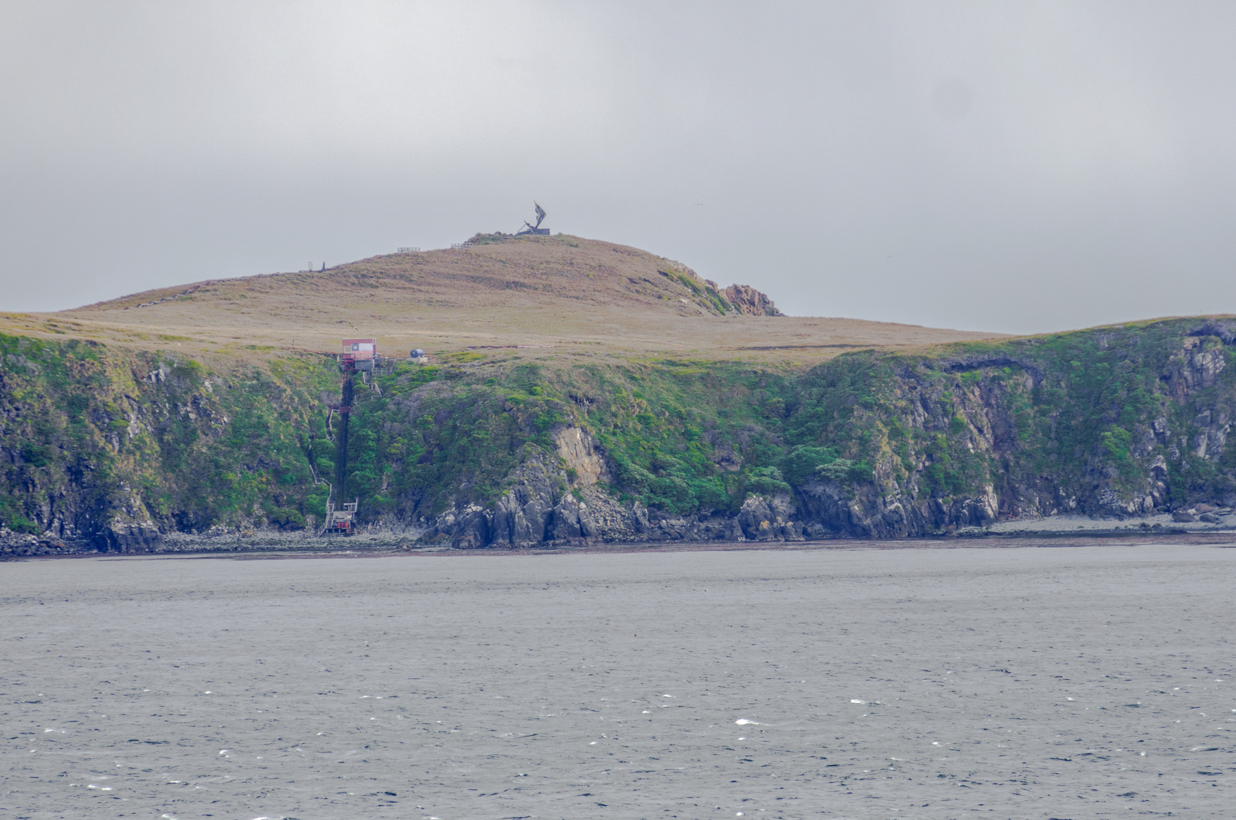
- Chilean Naval Station on Cape Horn


-

- Yes, it’s cold and windy.


-

- The Andes Mountains in the background.

-

- Andes in Chile

-

- High seas crash on rocks. Ship does NOT crash on rocks.


-

- Heading up the western side of Hornos Island

-

- Winds picking up: 42Kts/ almost 50mph.


-

- Starting a 360 degree turn of the ship so all sides can see Chilean Naval Station on Cape Horn.


-

- Sighting “Golden Princess” cruise ship also Rounding the Horn

-

- Naval Station on Cape Horn. A family with a 14 year old boy lives here. His social skills may be somewhat challenged.

-

- Albatross monument, half broke off in storm, so albatross not visible. Note stairway from rocky beach to top. And you thought carrying groceries in from the car was tough.
-

- Closeup of landing spot below Naval station. Rocks, not sand. No sun bathers.

-

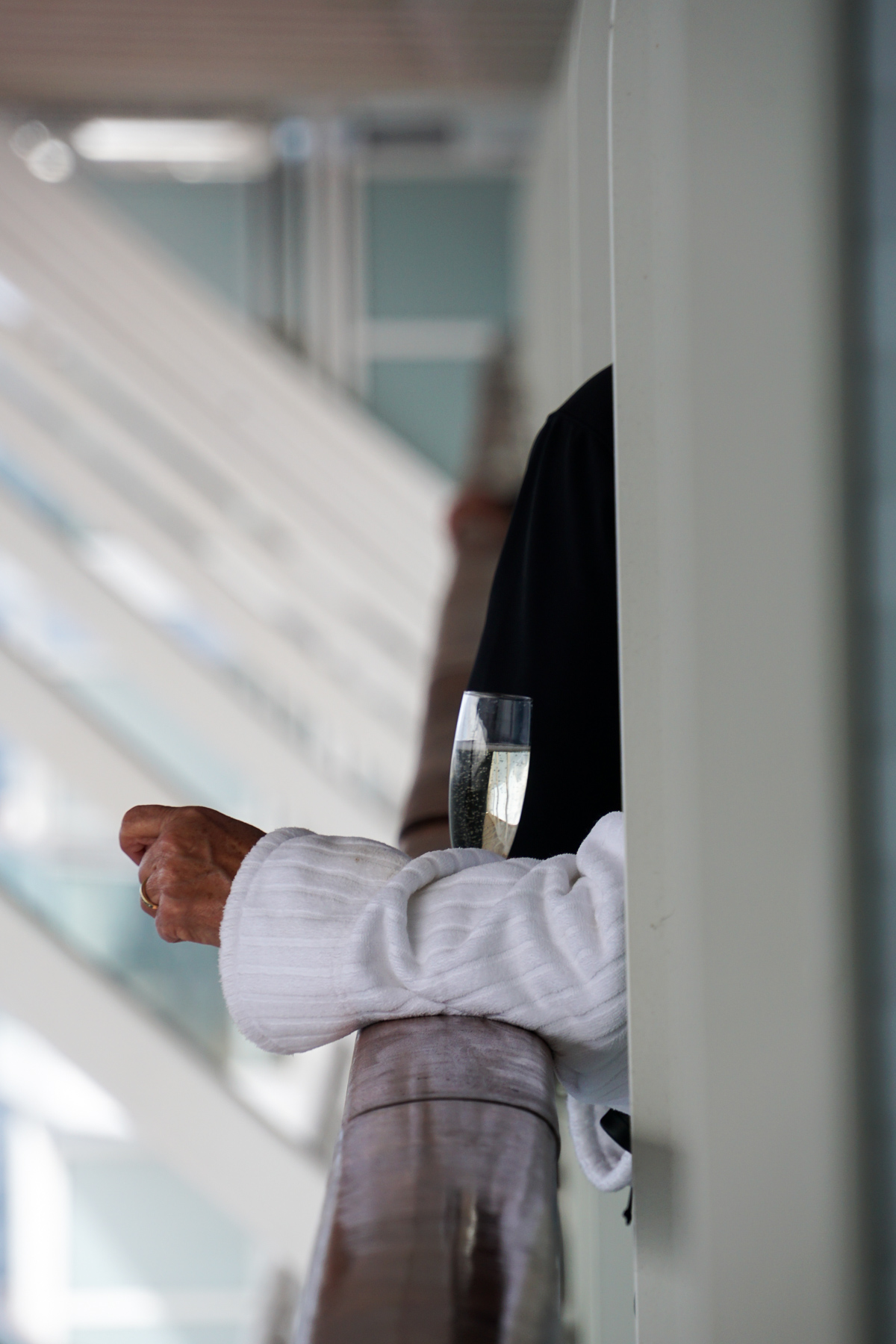
- Our neighbor watching scenery while sipping champagne. I’d prefer hot chocolate.
-

- Poop island.


-

- Closeup of Poop Island. Note birds lining ridge.

-

- Dead stop before heading back east toward tomorrows port-of-call.

-

- Leaving Cape Horn behind.
